Tracing Forgotten Streets: Who Lived in Your House, Pontrhydyfen
Pontrhydyfen and its surrounding communities—Efail Fach, Oakwood, and Tonmawr—hold a fascinating but sometimes elusive history.
Forgotten Street Names, Houses & Buildings
Many of the cottages, shops and other buildings in the area were built piecemeal, without the orderly planning we might expect today.
When we look back through census records, the challenge becomes clear: the neat, numbered streets familiar to us now often didn’t exist. In fact, some streets weren’t numbered until the 1930s.
Twyn y Pandy, for example, only adopted house numbers decades after its homes were first built. Some streets have vanished entirely—demolished and lost to time. Others were cleared and replaced with newer housing stock, erasing traces of the families and businesses that once stood there.
The Plas / Plas y Gog
Now known as Queen Street (number not known)
Sunny Bank
29 Twynypandy
Many of the houses in Twynypandy were known by their individual names e.g. Ael-y-Bryn or Gwendraith Villa. It is thought that numbering was not adopted until the 1930s.
Old Office Row
This house was originally used as offices by the Oakwood Iron Works, it was later converted into four separate dwellings.The building later became the Oakwood Vicarage, but a second vicarage was later built as a replacement in the 1970s. Both buildings are now private homes.
Oakwood Row
Often called ‘The Row’, it was demolished by the Council and replaced by the existing houses and flats found along Oakwood Ave
The Barracks
These cottages were demolished and replaced by several detached houses in Danybont (nos.15 – 19)
The Rhyslyn
Found below Pontrhydyfen Station, behind the Oakwood Colliery site which is now the Rhyslyn Field. The houses were demolished in the late 1960s. Several families were rehoused in Curwen Close
Bridge Meadow / Old Bridge Meadow / Waun y Bont
Various houses in Danybont once stood along the roadside each side and between the Aquaduct and Viaduct. Many were demolished at various times and are captured in many photos.
Pontycymmer
These refer to the cottages built on each side of the railway viaduct. The row of cottages on the Cwmafan side of the viaduct can be seen in some photos of the area. Several historic newspaper reports commented upon the lack of sanitation in these houses
Station Road
A row of terraced cottages ran alongside the road from Jerusalem cemetery. The majority of which were demolished, only some remain, often combined or extended to provide larger living accommodation.
The Heart of Oak Public House
This pub is probably one of the older pubs in the village situated at the end of Queen St below Jerusalem Chapel. The pub gave its name to the steep ‘Heart of Oak hill’ running down to Danybont. After closure, a sweet & chocolate shop opened on the premises
The Gangen / Y Gangen (The Branch)
This was a Methodist place of worship found in Efail fach. It was demolished and replaced with a house in the late 1970’s (number 4)
The Bungalow
This may refer to the older Bungalow stock that still stand in Curwen Close today. Newspaper reports during the First World War stated that Belgian refugees were housed here
The Kings Head
Pub that once stood next to Jerusalem cemetery, this is the only remaining building at this end of Station Road, a butchers shop was found next door
The Boars Head
Pub that once stood alongside the Miners Arms at the end of Lewis Street. This site later went on to become a grocer’s shop – Gethin’s
Pandy
In an Ordinance Survey map of 1875, an ‘Old Factory’ was located downstream of the Woollen Mill in Cerrig Llwydion, where Twyn Pandy and Morgans Tce is now located. ‘Pandy’ is a Welsh word for Fulling Mill (or Tucking Mill), which is a mill used in a textile finishing process that cleans and thickens woven woollen cloth. This improves its durability and water resistance. Tithe maps of this area refer to this area as having a Tucking Mill
The Pandy Stores was located in Morgans Terrace for a several decades and closed in the 1960s
Harris Street / Harris Row
Now known as 8-10 Uplands
Institute Buildings / Pontrhydyfen Conservative Club
Now known as 1-2 Wern View
Rees Terrace
Now known as 1-3 Cerrig Llwydion
Roberts Terrace / Roberts Cottages
Now known as 8 -11 Cerrig Llwydion
Mercantile Row
Originally named after the Mercantile colliery, later known as Garth Tonmawr Colliery. Now, Fforchdwm Row / Upper Tonmawr
Darren Row
14-17 Efail Fach
Lost Shops, Buildings and Traders: Many small shops could be found in and around the village. Can you remember any of these, or can you remember more?
Dewi’s
Penhydd St, Oakwood, kept by Gwyn & Eluned Llewellyn until mid-1970s
Betsan’s Hairdressers
Gethin’s The Grocers
Lewis St, sold a wide range of produce up until late 60’s / early 70s
Midland Bank
1 Morgans Terrace, occupied by Mr & Mrs Rees
Pandy Stores / Pope’s shop
7 Morgans Terrace, grocers run by the Pope family
Olive Jane the Drapers
Drapery business in Queen St
Mrs Thomas The Chip Shop
Queen St, was ‘Jenny’s’ first located here before moving to the old Co-op?
Betting Shop
At the side of the old Welfare Hall
Chip Shop / Hairdressers
In a small, detached building at the end of Morgans Terrace (now demolished)
Church Hall
Enugu Lodge. Where St Johns Church held many bazaars and concerts
The Mission / Band of Hope
A detached structure made from tin sheets located between Twyn y Pandy and Bevans Terrace. Is this one of the same building, lost in the 1970s?
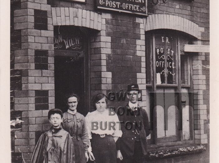
Pontrhydyfen Co-operative and Industrial Society
Originally a two storied shop with bakery, grocery, haberdashery and much, much more. Now the only shop left in the village, it has been split into two with a pizza takeaway
Harry Rees the Butcher
Located in Morgans Terrace, owned and run by 3 generations of the Rees Family. Sadly closed in the last decade.
Doctors surgeries
More than one doctor held surgeries and clinics at various addresses in the village. These include Bryn Elfed, 10 Morgans Tce and The Community Centre
We would like your help with the following:
A lady’s clothes shop located in Morgans Tce (towards end of Bevans Tce.)
A shop located at the corner of Tonmawr Road Efail fach
The Project: Who Lived in Your House
For anyone trying to discover “Who Lived in Your House”, the journey can feel like detective work. Our ongoing project, Who Lived in Your House, has already uncovered fascinating details about Pontrhydyfen’s past. But we know there’s more to the story.
We’re piecing together missing or forgotten streets, rediscovering stories of houses, shops, and the people who shaped our town. Every clue adds another layer to the rich tapestry of local history.
If you have memories, photographs, or information about lost streets and buildings, we’d love to hear from you. Your contributions could help preserve the heritage of Pontrhydyfen for future generations.
Acknowledgements
A heartfelt thank you to Jason Jarvis for his expertise and immense knowledge, which has been invaluable in supporting this project.
A gallery of other streets, houses and sites around Pontrhydyfen.
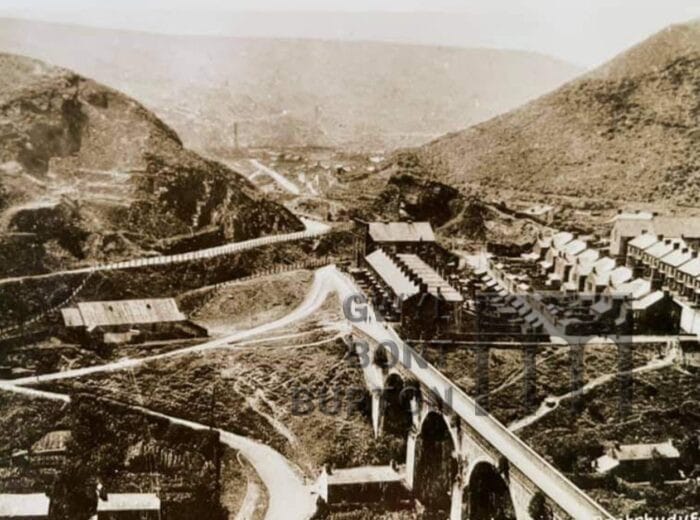
The Barracks and Railway Bridge
The Barracks and Dan Y Bont
Rufie Snell’s Dan Y Bont
Rhyslyn Houses and Vine Church
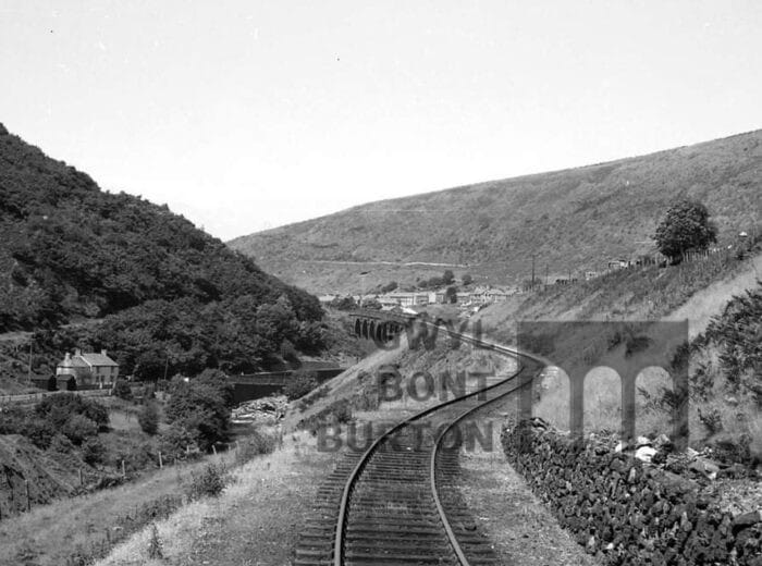
Railway looking towards Oakwood
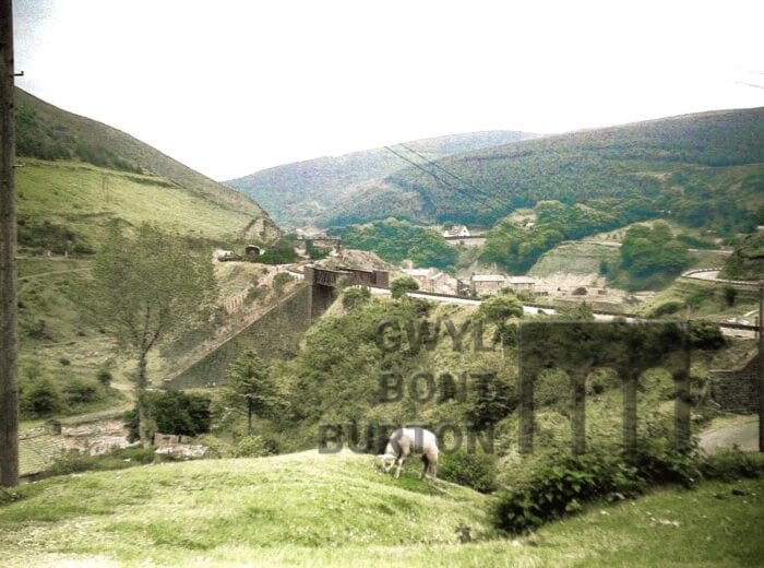
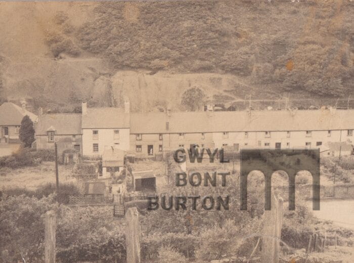
Pontycymmer Row, Dan Y Bont 1906
Pontrhydyfen Welfare Hall
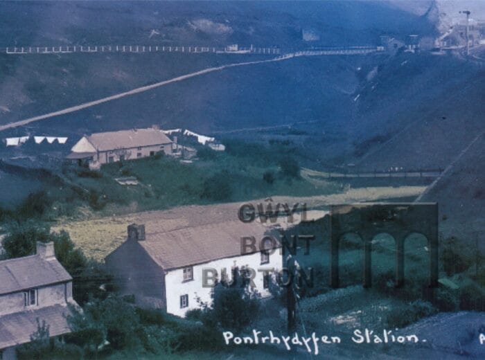
Pontrhydyfen Station and The Barracks, Dan Y Bont
Pontrhydyfen Station and Rhyslyn
Pontrhydyfen and Morgan’s Terrace
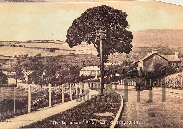
from Penhydd
Pontrhydfen street
Penrhys Fawr
Penhydd Street 1913
Old mill with Cerrigllwydon and Bevans Tce 1930s
Oakwood Villas
Oakwood Row
Oakwood Row
looking toward Foel with drift mines and spoil heaps in background
Oakwood Row and St Johns Church 1930s AM
Oakwood Row and school
Oakwood railway
train crash
Oakwood from Penrhys
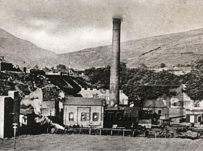
Oakwood Works in background
Oakwood Colliery and Rhyslyn
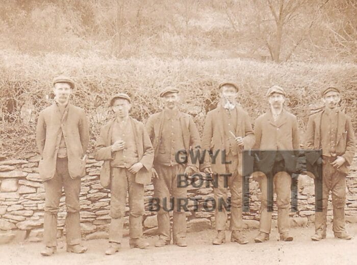
Miners near Efail fach mill 1915 JJ
Millwright Arms and Railway
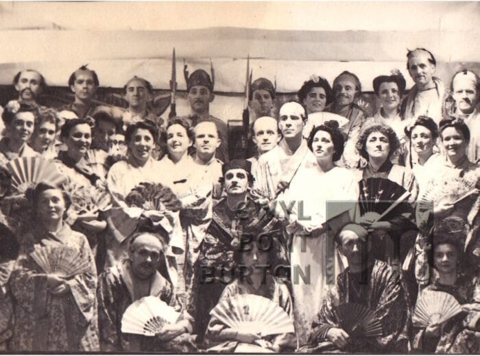
Mikado
Meeting Richard Burton's family
Liz Taylor with, from the left, Mrs. Hilda Richard’s sister, Mrs. Hyrel Jenkins and Mrs. Betty Jenkins, two of his sisters.